

Race Details
Date, time, and location – all you need to know about this year’s race.

FAQs
Find answers to your questions about this year’s race.
Rules
Discover the need to know specifics that govern this year’s race.
Date, time, and location – all you need to know about this year’s race.
Find answers to your questions about this year’s race.
Discover the need to know specifics that govern this year’s race.

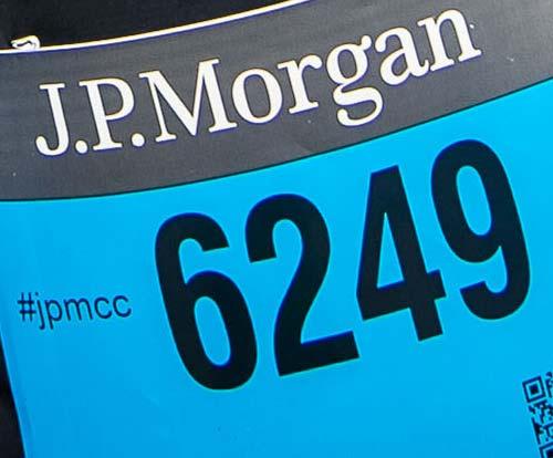
The J.P. Morgan Corporate Challenge Series is a world-wide series of 3.5-mile (5.6-km) running events open to groups of full-time employees from organizations within the business and public sectors. Participants may register only as part of a company team - no individual entries are accepted. After the race, each organization groups its participants into an unlimited number of four(4)-person teams in order to determine the race's top teams. Awards are presented for individual and team performances.
Each company entered is led by a Company Captain, who creates the company team, recruits participants, and manages the team. Teams of competitive runners have a chance to qualify for the Series Championship, where they will compete against the champions from all the Series events for top honors in the corporate running community.
Participating companies use the event as a platform to promote health and fitness in the workplace, foster goodwill and camaraderie among their employees, and show their commitment to the community and best environmental practices. The Corporate Challenge strives to make a difference through a donation to a not-for-profit organization in each host city, and through our operations initiatives designed to make the Corporate Challenge the world's greenest road race.
| Date | |
|---|---|
| Time | |
| Location | |
| Distance |
| Entry Fee | |
|---|---|
| Entries Open | |
| Entries Close |
If you are interested in becoming a Team Captain in 2021 and your company has never registered for the J.P. Morgan Corporate Challenge Boston, please signup for the Team Captain mailing list by contacting boston@corpchallenge.jpmorgan.com.
Payment option information for the 2021 J.P. Morgan Corporate Challenge Boston coming soon!
Conventures, Inc.
boston@corpchallenge.jpmorgan.com
888-767-7223
88 Black Falcon Ave
Suite 202
Boston, MA 02210
Race Packet Pickup for the 2021 J.P. Morgan Corporate Challenge Boston coming soon!
The J.P. Morgan Corporate Challenge will be scored using a chip scoring system. Each runner number will have a timing chip affixed to the back. Official timing for team scoring purposes begins when the participant crosses the start mat.
The Company Captain will determine the composition of the male, female and mixed teams representing his/her company AFTER the race. Teams must be organized online using Captain's Tools and in accordance with the scoring rules located on the Event Details page.
Participants will be automatically organized into 4-person male, female, and mixed teams based on the chip times. Each name will be assigned to only ONE (1) team. The score for each team is obtained by adding together the finish times for all four (4) members.
Complete teams are composed of:
Company captains must confirm their teams online the day after the race by using Captain's Tools. You may re-organize the automatically assigned teams at this time if desired or necessary.
Individual and special awards will be listed on this website following each race. Team results will be added as soon as they are verified.
Teams of competitive runners have a chance to qualify for the Series Championship, where they will compete against the champions from all the Series events for top honors in the corporate running community.
A scoring team is made up of either four (4) males, four (4) females, or two (2) males and two (2) females. These teams will be made up of the four (4) fastest runners in each scoring category. The team captain will be able to create and submit the scoring team using Captain's Tools.
Learn more about Scoring rules go to our Event Details page.
| Deadline | |
|---|---|
| Notes |
Site Map for the 2021 J.P. Morgan Corporate Challenge Boston coming soon!
J.P. Morgan, in celebration of the Corporate Challenge, will make a donation to a local not-for-profit organization. J.P. Morgan makes locally-designated donations in each of the 15 Corporate Challenge events in seven countries on five continents.
 FAQs">
Event Information FAQs

Championship Eligibility
Code of Conduct for All Participants
At any Race in the Series, all participants must follow these Rules of Competition and conduct themselves in a courteous manner, showing respect for all fellow participants, volunteers, Race staff, and members of the community. Proper race etiquette is required at all times, including being aware of surroundings and any announcements and following instructions from Race officials. Unsportsmanlike conduct will not be tolerated.
Start
Participants must arrive early enough to enter their corrals on time. They must remain respectfully quiet during pre-Race announcements and the playing of the national anthem (in the U.S. only).
Headphones
The use of headphones or earbuds is strongly discouraged. If participants wear headphones, they shall ensure that they can hear all announcements and/or instructions and remain aware of their surroundings, including other participants.
Urination
In accordance with city ordinances, participants may only urinate in provided toilet facilities. They must be considerate in Porta Potty lines (never cutting ahead of others). Public urination in any part of the Race venue, course, village, or otherwise could result in disqualification and a police summons.
Running Courtesy
Race Attire
Male participants are strongly discouraged from racing without shirts and/or removing their shirts during the Series. Runners must wear their bibs on the front of their torsos, where they can be visible at all times.
Trash
Races are conducted in public parks and streets. Participants must deposit all trash in provided receptacles, including at water stations where they must take care to avoid hitting other participants with discarded cups. Recycling and compost bins should be used whenever possible.
Safety
If any participant encounters a runner in distress, they should offer assistance and/or report the situation to the nearest aid station. If possible, they should also call 911 (U.S. Races) or the local emergency medical number.
The following items are prohibited from all J.P. Morgan Corporate Challenge events and race venues:
Violation of any of the rules indicated herein, in the Race registration packet, pre-Race electronic communications, and/or in Race announcements, may result in disqualification of any participant, team, and/or the entire company for the applicable Race and/or future Series events or Races. The decision of the ERC and the Series Owner is final.